We have a couple of volcanoes within eye shot of my area. To visit both in one day it's about a 150-200 mile trek. But there are a few points of interest along the way I discovered a while back. We took a camera and the camcorder. Since I still can't figure out Sony Vegas yet, I decided to pull out a few snapshots off the tape.
We travelled south on I5 from the City of Shasta Lake to Hwy 44 east down I-5 to Redding. Travelling east, we encountered a detour and had to travel even farther south almost to Anderson before we could cut back up to 44 just outside of Shingletown. From there it is a nice drive through the trees all the way to the intersection of 44 and Hwy 89.
The intersection is also where the entrance to Lassen National Park is. The road closes in the winter months due to snow and isn't opened again until around Memorial Day. Just north of the park is where our adventure begins....
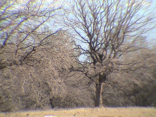
Subway Caves
The Subway Caves were created by lava flow from one of the Mt. lassen eruptions. I believe the last eruption was around 1916 or 15.
The entrance to the cave is just a few hundred yards from the parking area. They have some pretty nice stairs to take you down in
This is our first view of the cave. This is where we checked the flashlights to make sure they were working. Most of the cave is pretty much like this except for one cave-in about 3/4 of the way through. Unfortunately, even though my camcorder does fairly well in dim light...flashlight doesn't cut it. I even had my small light going on the camera but most of the shots through the cave are totally black.
These are the exit stairs and our first view of the way out. It had been maybe 30 years since I had been here and had much different memories of the experience. I think it took all of 15 minutes to get through from end to end.
This is the right side of the exit of the cave. The formations of the rocks were more interesting in person. It's truely difficult to capture the moment in poor light with a camera you are just learning to use.
The Search for Extraterrestrial Inteligence
The University of California maintains an array of radio telescopes used by S.E.T.I for listing to our neighbors. Unfortunately the site is closed on the weekend. It is located about 10 miles south of the intersection of Hwy 299 and Hwy 89 and off the road east about a mile.
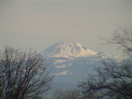
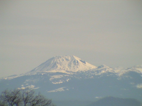
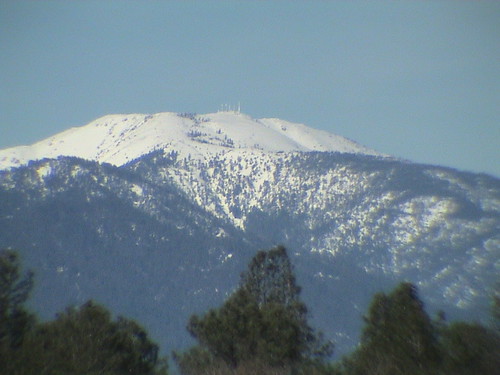
Here's a view of Mt Lassen from where we are parked. You really can't ask for much more. It was a little windy but heh! We were at around 4000 feet here so it's supposed to be windy right?
If you look real close you can see the array for satellite dishes. They are the white things in the center of the picture. Someday I'll get to see them up close and get a better picture. As I understand it, they are develepong a new type of array for the S.E.T.I program but can't remember the details.
Of course here's a picture of the Jeep and the small lake behind the Jeep where we parked to see the array. Not sure if there are any fish in there or not but it looks promising if you could get a boat in there.
MacArthur-Burney Falls State Park
Our adventure continues at Burney Falls which is 6 miles north of the intersection of Hwy 299 and Hwy 89 (on 89). It's time for lunch!
After paying our six bucks to get the car in, we proceeded through the park to the lake. They have a really nice picnic area, boat ramp etc. Nice place to relax and stuff your face. I didn't take to much time taking pictures of the lake. We were there for other reasons....
Burney Falls
The temperature is about 10-15 degrees cooler at the base of the falls then the top of the falls. If you look close at some of the pictures you can see water coming out of the rock. Because of the volcanic activity in the area, the face of the falls is actually porous. During certain times of the year the water coming down the stream dries up and the water goes underground. The underground water shoots out the face of the falls and keeps this spectacular beauty alive.
You will notice that one of the shots are from the far side of the falls. They have a 1.5 mile loop trail to take you back to the parking lot. The last picture in the group is the creek above the falls. Below you can see some of the statistics of the falls and an interesting tree section. The entire section has plaques of all the major events since it first sprouted.
McCloud Falls
The McCloud Falls are also located off of Hwy 89 about 5 miles south of the town of McCloud. There are actually 3 falls the make up the McCloud Falls...Upper, Middle, and Lower falls. The roads back into them have improved over the last few years and so has the general access.
This is the Swimming Hole above the Upper falls. Kind of out of the way but a really nice spot. The kids have fun. I'm not sure if they are locals or tourists. McCloud is one of those towns that if you see more than 10 people in one spot there is a BIG doins go on.
The Upper Falls
The Middle Falls
The Lower Falls
From here we went on a drive through of McCloud to see some of the old buildings and then on to the city of Mt Shasta.
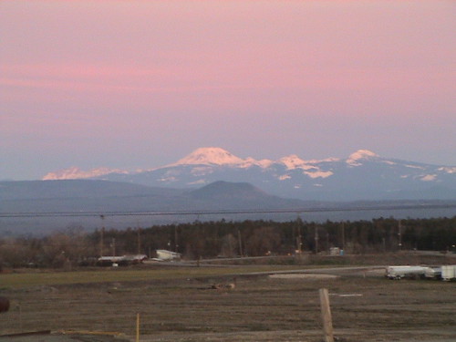
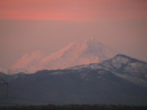
Mt Shasta
Was checking out the telephoto lens and the optical zoom on the camera for these shots.
These are taken from the downtown area of Mt. Shasta. Geographically you are looking at the Southwest side of a 14,000+ foot volcano. Crazy place to build a city but oh well. I guess its not much different than building a house on a cliff at the beach and not taking the erosion factor in to consideration. Both Lassen and Shasta are listed as active volcanoes. We are 50 miles from each of them so rather safe from all but the ash if the wind blows right.
There is one last detail to mention about the trip...we visited the headwaters of the Sacramento River before we headed home down I-5. There is a spot where it is less than 3 feet wide where we went right in the city outskirts. I understand that the river spews out of a rock at the very beginning of it but well save that for yet another adventure.
Read and post comments | Send to a friend


